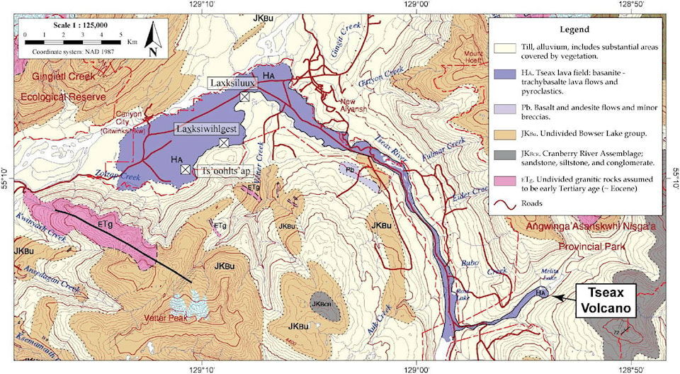
University scientists have published the first extensive map of the Tseax Volcano, located in Nisga’a territory.
The Tseax Volcano erupted approximately 250 years ago, 87 km north of where Terrace sits today. The resulting lava flow is believed to have killed approximately 2,000 Nisga’a people, destroying three villages in the Nass Valley. This scientific understanding is corroborated by Nisga’a oral history. Now the vast fields of lava rock are preserved as a provincial park, jointly managed by the Nisga’a Lisims government and the B.C. government.
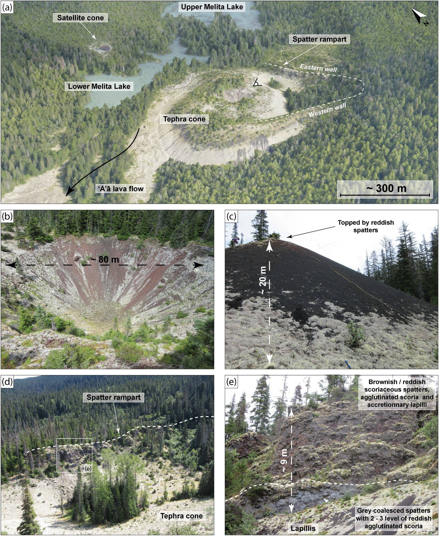
The volcano has been researched before, but until now there had never been extensive mapping of the volcano cone or the beds of lava rock that were formed when lava flowed 32 km into the valley, nor had a precise timeline of events been established.
In summer 2016, researchers from SFU, UBC, and Quest University in Squamish began fieldwork in the lava beds, returning again in the summers of 2017 and 2019. They studied the surface of the lava beds, measured the depth of the lava beds at various points, and measured the depth of Lava Lake and Melita Lake, to determine how much lava had flowed into those waters. The researchers also obtained aerial photos of the volcano cone and lava beds. The data was then punched into 3D modelling software for further insight.
The research culminated in a paper called “Physical volcanology of Tseax Volcano,” which was published online May 12. Lead author of the paper Yannick Le Moigne is a PhD candidate at SFU and the paper is his PhD thesis.
Le Moigne told The Terrace Standard that the biggest surprise from the research was just how much lava flowed from the relatively small volcano.
“The volcano is very, very small compared to the lava flow,” he said, comparing the size of the lava flow to the size of the Skeena River today. “[It was] an enormous volume of lava flow, very hot … flowing like a river in the valleys, reaching the [Nisga’a] villages in a day or two, destroying everything in its path.”
Many of the Nisga’a people were killed by a poisonous gas, not the lava itself, according to Nisga’a oral history that was recorded in the Canadian Geographical Journal in 1935. Le Moigne said that is likely true, but he and other researchers can only speculate about gasses related to the eruption.
“They were not necessarily killed by the lava flow, but maybe once the lava flow arrived, was in contact with the Nass River, there would have been some gas emissions,” he said. “When you have … a very hot lava flow, in contact with the cold water like the Nass River, you have a lot of emissions of vapor of water, but also any volcanic gasses like CO2, sulphuric gasses, etc., and if you smell those gasses you could be in trouble.”
The Tseax Volcano is unlikely to erupt again, Le Moigne said. It was formed as the result of rifting, where two tectonic places pull apart, thinning the Earth’s crust and allowing magma to spill out from the Earth’s mantle. This process typically results in volcanos that only erupt once, which is true for most volcanos in northern B.C. and Alaska.
“All these volcanos, like 90 per cent of them, are monogenetic volcanos, because they only erupted one time, and then [they stop],” Le Moigne said. “So, at the moment, we are thinking that Tseax is also a monogenetic volcano … But we are not 100 per cent sure, maybe in the future there will be another eruption.”
Le Moigne, who is from France, said he chose to come work on the Tseax Volcano for his PhD because the volcano had barely been studied.
“It was an opportunity to study everything, from the basic, to the more complex history of the volcano,” he said.
Nisga’a people provided great assistance to the research, Le Moigne said, a contribution not available in most earth science studies.
“They gave us a lot of data from their oral histories, and that helped us a lot when we wrote, step by step, what happened at Tseax,” he said. “This is a very cool project to merge the two aspects of the world. You have the [earth] science, and then you have the … social science from the Nisga’a.”
jake.wray@terracestandard.com
Like us on Facebook and follow us on Twitter