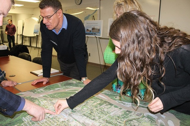
Residents, city staff and planning consultants mingled last night at an open house, part of the $75,000 Transportation Master Plan commission by the city.
Those visiting the city hall event were given red and green stamps and asked to place them on a large map laid on the table. Green stamps could be placed on positive features of Terrace, while the red stamps were stuck to problem spots.
These suggestions from the public are being used to guide the plan being put together by McElhenney Consulting over the next four months.
The company's spokesperson for the project, Prince George-based senior transportation engineer Glenn Stanker, said that the secret to the success of thriving cities is having a vision and plan.
“Vision is important, and the number one thing is having a plan. When you apply for a grant, they will ask to see a plan that supports the project,” he said.
So what will Terrace's transportation priorities be? This is what Stanker and his team, along with the city, are working on.
Aside from the public consultation, there is also an online survey to gather what residents want in terms of improving transportation for vehicles, cyclists, and pedestrians.
There are many categories of city project being looked at, and prioritized.
These include the tops and bottoms, as well as the widths and safety features, of Lanfear and Kalum hills.
Options discussed at a committee of the whole meeting also held yesterday included widening the street and/or sidewalks on these hills, and possibly closing Pheasant St. to thru-traffic at the bottom of Kalum in order to improve pedestrian flow.
Stanker said his team will look at options to making the hills safer in the short term, as they are steep, narrow, windy and much used by all sorts of commuters who tend to “compete” for room.
Intersections are also being studied.
Stanker said that Lakelse and Sparks is an example of a challenging intersection. So is Eby and Lakelse which he said “may not be intuitive to drivers”. Also, the intersection of Thomas, McConnell, Cooper around school hours. He said there could be ways to improve these and other intersections.
Rail crossings are another item included in the planning, with the “non-conventional” crossing of the tracks by pedestrians and the need for some sort of pedestrian overpass. A location for this could be part of the plan as well.
After stakeholder consultation, the next phase is data collection followed by detailed analysis in April, then May will see improvement options conceived, then in June the review will be ready, followed by a final report.