The Transportation Safety Board (TSB) has released more details of the plane crash near Smithers that killed three people—including Lorne Borgal, the former CEO of Hudson Bay Mountain Resort—and sent another to hospital.
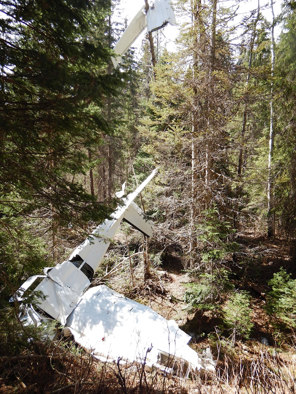
In a preliminary report on its website, the TSB reports the Cessna 182E operated by Lakes District Air was on an aerial mapping mission north of Smithers.
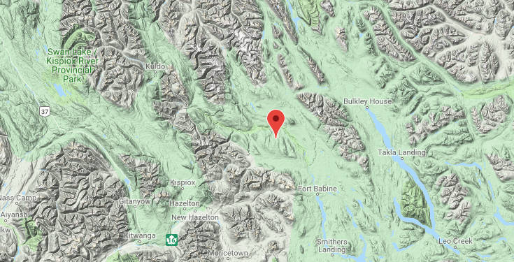
“About three hours into the flight, the pilot transmitted a Mayday before communication was lost,” the TSB said. “The wreckage was located approximately 50 nautical miles north of Smithers adjacent to the Babine River. The aircraft was destroyed due to collision with the terrain.”
The survey the four contractors on the plane were conducting was on behalf of the BC Wildlife Service.
Doug Donaldson, minister of Forests, Lands and Natural Resource Operations and Rural Development said in a statement they were doing infrared scans of some of the sites of 2018 wildfires.
“Our thoughts are with the family and friends of everyone involved in this incident,” he said. “On behalf of all British Columbians, I would like to extend our deepest sympathies to the families and friends of the three people who did not survive.”
No cause for the crash has been determined yet. The probe is being conducted by Travis Shelongosky, a senior investigator with TSB since 2001 and licensed pilot, who is a graduate of the British Columbia Institute of Technology’s Aircraft Maintenance Engineer (AME) program.
The BC Coroner’s Service is also investigating.
A second victim has also been identified. Amir Sedghi, was an analyst with Precision Vectors, an aerial imagery company founded by Borgal.
The fourth person is expected to recover, Donaldson said in the statement.