The Terrace Regional Historical Society has a plan for the cenotaph just in time for the 50th anniversary of its unveiling and are looking for some help from the public too.
At its January meeting, the society decided to ask for help from the city to get the cenotaph on Heritage BC’s new program Get on the Map: War Monuments and Memorials in British Columbia, which will be an interactive online map.
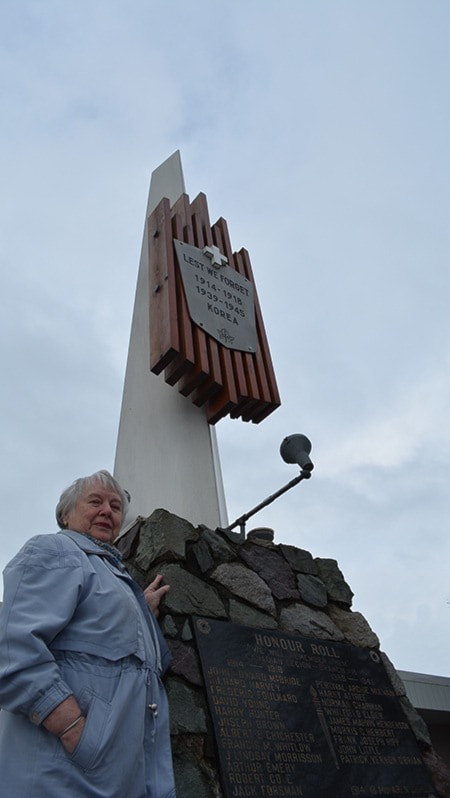
The Terrace cenotaph is one of more than 6,000 monuments and memorials dedicated to Canada’s war dead in the First and Second World Wars.
The society is gathering information and photos about the cenotaph, but have come up short on certain types of photos.
Photos of the unveiling ceremony of the cenotaph on Nov. 6, 1966 are quite difficult to find; there is one on a scanned copy of a page from the Terrace Omineca Herald from Nov. 9, 1966 and another on a page from Nov. 10, 1978 but that’s all that’s been found, according to society member Helene McRae.
Anyone with photos of the unveiling of the cenotaph is asked to contact the society or the city so the photos can be included in the application to Heritage BC.
Also, McRae noted that the stonework below the base of the cenotaph wasn’t there at the unveiling or in the 1978 photo and was added later.
She isn’t sure when it was added or who did the stonework and would like to find out.
She believes it’s sometime between 1978 and about 1985, when photos of the cenotaph show the stonework too.
Anyone who knows when the cenotaph was raised and put on top of the added stonework and who did the stonework itself can contact the society or the city.
McRae said local historian Yvonne Moen and one of the city planners, Ken Newman, are assisting the society with the application to get on the map.
Newman assisted with the cenotaph’s GPS coordinates, letting the society know what kind of information was needed and after the society gathers photos, articles and any other information, he will put it together, fill out the forms and submit it.
The deadline for information to be submitted to the program is March 1.
Heritage BC’s project will be accessible to everyone online and serve as an educational resource about Canada’s war effort and the effects on local communities.
It gives communities the opportunity to share their stories, heritage, and history.
War memorials and monuments can include not just cenotaphs but also commemorative plaques, park gates or whole buildings.